| Paperback | |
| 200 Pages | |
| (H) 254mm, (W) 178mm, (D) 16mm |
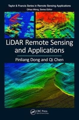
LiDAR Remote Sensing and Applications
£74.95Description: LiDAR (Light Detection and Ranging) is a remote sensing technology that measures distance by illuminating a target with a laser and analyzing the reflected light. This book introduces the fundamentals of LiDAR remote sensing, LiDAR data processing and analysis methods and applications of LiDAR in forestry and vegetation mapping, urban environments, and geosciences. It includes 11 hands-on projects with step-by-step instructions and many up-to-date studies, and can be used as a textbook or reference in fields related to those listed above
Review: "LiDAR is an incredibly useful data and technology that has been making positive impacts in many areas of society, including natural hazard mitigation, city planning, and many other sectors. Teaching with and learning about LiDAR technology has been challenging for instructors and GIS practitioners because of the lack of useful and practical activities, data sets, and projects. Dong and Chen's LiDAR Remote Sensing and Applications book will help fill this gap because their book includes a set of hands-on projects with step-by-step instructions, with accompanying very useful data sets on a variety of themes and scales." - Joseph J. Kerski, Esri, Broomfield, Colorado, USA "LiDAR Remote Sensing and Applications is an indispensable reference for those working with LiDAR data. Combining detailed background information, a comprehensive review of the literature, and a clear explanation of typical analytical approaches, the book focuses in particular on forestry, urban and geoscience applications. A key strength of the volume is the inclusion of tutorials and the associated data for 11 projects, allowing the reader to explore the applications presented and thus truly get to grips with the subject matter." -Timothy Warner, West Virginia University, USA "This is a good book for those who would like to understand the applications of Lidar without going into the technical details of Lidar technology, data pre-processing and processing." -Arup Dasgupta in Geospatial World
Contents: 1. Brief Overview of Remote Sensing 2. Principles of LiDAR Remote Sensing 3. Basics of LiDAR Data Processing 4. LiDAR for Forest Applications 5. LiDAR for Urban Applications 6. LiDAR for Geoscience Applications
Author Biography: Dr. Pinliang Dong is a Professor in the Department of Geography and the Environment, University of North Texas (UNT), Denton, TX, USA. He received his B.Sc. in geology from Peking University, China in 1987, M.Sc. in cartography and remote sensing from the Institute of Remote Sensing Applications, Chinese Academy of Sciences in 1990, and Ph.D. in geology from the University of New Brunswick, Canada in 2003. Before joining UNT in 2004, he worked as a Senior GIS Analyst/Programmer at Titan Corporation in California (USA) and Okinawa (Japan), and a Staff Associate/GIS Specialist at the Center for International Earth Science Information Network (CIESIN), Columbia University. His research interests include remote sensing, geographic information systems (GIS), digital image analysis, and LiDAR applications in forestry, urban studies, and geosciences. He has taught Intermediate GIS, Advanced GIS, Advanced GIS Programming, Remote Sensing, Special Topics in GIS: LiDAR Applications, and China Field School; mentored over 30 Master's and doctoral students and two post-doctoral fellows; and hosted over 15 international visiting scholars. He is a member of the American Association of Geographers (AAG), American Geophysical Union (AGU), and International Society for Digital Earth (ISDE). Dr. Qi Chen is a Professor in the Department of Geography at the University of Hawaii at Manoa, Honolulu, Hawaii, USA. He received his B.Sc. and M.Sc. in Geography in 1998 and 2001, respectively, from Nanjing University, China, and Ph.D. in Environmental Sciences, Policy, and Management from the University of California, Berkeley, USA in 2007. He joined the University of Hawaii at Manoa as a tenure-track Assistant Professor in 2007, was tenured and promoted to Associate Professor in 2012, and was promoted to Professor in 2017. His early interest and research in LiDAR remote sensing during his Ph.D. study were to develop effective methods for LiDAR data processing and information extraction, including airborne LiDAR point cloud filtering, digital terrain model generation, and individual tree mapping. His research in recent years has expanded to satellite LiDAR, terrestrial LiDAR, and the use of LiDAR for extracting various vegetation attributes for applications such as wildfire mapping and hazard analysis, biodiversity and habitat analysis, and biomass mapping and estimation. His overall interest in LiDAR remote sensing is to improve the methods of information extraction from LiDAR and to promote the use of LiDAR for assisting environmental management and decision making. He is an adviser to many Master's and doctoral students, postdocs, and has hosted many international students and professors for studying LiDAR in his research lab. He has also given multiple tutorial workshops on LiDAR remote sensing in international conferences organised by professional societies.
Publisher: - CRC Press - more
Code: - 9781138747241
Year: - 2017 12 (Dec)
Authors: - Pinliang Dong, Qi Chen


